Ask anyone who snorkels or dives at the Blue Heron Bridge when to go and you get the same answer: around high tide. Divers Alert Network put it plainly in an Alert Diver guide by Jim and Deb Garber, dated Aug. 18, 2022: “Diving BHB revolves around slack high tide, which offers the calmest currents and best visibility.” What the advice rarely includes is the time. This post shows how, using NOAA’s published tide predictions: a worked example for the seven days from Tue., Oct. 20 to Mon., Oct. 26, 2026, then a live table for the next seven days, so you can plan any week the same way.
The example week in one line
Afternoon highs from Tue., Oct. 20 (4:32 p.m.) through Fri., Oct. 23 (6:48 p.m.), then morning highs from Sat., Oct. 24 (7:18 a.m.) to Mon., Oct. 26 (8:50 a.m.). All times are NOAA predictions for Port of Palm Beach.
Worked example: daylight high tides, Oct. 20 to 26, 2026
The times below come from NOAA’s CO-OPS high and low predictions for station 8722588, Port of Palm Beach, the nearest NOAA tide prediction station to the Lake Worth Inlet and the bridge. Times are local and heights are in feet above mean lower low water (MLLW). We count a high tide as daylight when it falls between 7 a.m. and 7 p.m.; that is our planning window, not an official one. This table is generated from the prediction file each time the page is built, not typed by hand.
| Day | Daylight high tide | Predicted height (ft, MLLW) |
|---|---|---|
| Tue., Oct. 20 | 4:32 p.m. | 3.2 |
| Wed., Oct. 21 | 5:20 p.m. | 3.3 |
| Thu., Oct. 22 | 6:05 p.m. | 3.4 |
| Fri., Oct. 23 | 6:48 p.m. | 3.4 |
| Sat., Oct. 24 | 7:18 a.m. | 3.8 |
| Sun., Oct. 25 | 8:04 a.m. | 4.0 |
| Mon., Oct. 26 | 8:50 a.m. | 4.1 |
The pattern is easy to see. From Tue., Oct. 20 to Fri., Oct. 23 the daylight high falls in the afternoon, moving from 4:32 p.m. on Tuesday to 6:48 p.m. on Friday. On Sat., Oct. 24 it jumps to the morning: 7:18 a.m. on Saturday, 8:04 a.m. on Sunday and 8:50 a.m. on Monday. Within each run, a daylight high arrives about 46 minutes later than the one the day before. Predicted heights run from 3.2 feet on Tue., Oct. 20 to 4.1 feet on Mon., Oct. 26.
Evening highs at 7:30 p.m. on Sat., Oct. 24, 8:13 p.m. on Sun., Oct. 25 and 8:58 p.m. on Mon., Oct. 26 fall after 7 p.m. and are left out. Palm Beach County permits diving at Phil Foster Memorial Park from sunrise to sunset, so check the sunset time before you plan around a late afternoon high like the 6:48 p.m. one on Fri., Oct. 23.
The next seven days
Fri, Nov 20
- High 4:07 a.m.3.1 ft
- Low 10:13 a.m.0.9 ft
- High 4:18 p.m.3.0 ft
- Low 10:26 p.m.0.4 ft
Sat, Nov 21
- High 4:59 a.m.3.4 ft
- Low 11:07 a.m.0.8 ft
- High 5:06 p.m.3.0 ft
- Low 11:14 p.m.0.2 ft
Sun, Nov 22
- High 5:49 a.m.3.6 ft
- Low 12:00 p.m.0.6 ft
- High 5:54 p.m.3.1 ft
Mon, Nov 23
- Low 12:03 a.m.0.0 ft
- High 6:39 a.m.3.8 ft
- Low 12:51 p.m.0.5 ft
- High 6:44 p.m.3.2 ft
Tue, Nov 24
- Low 12:52 a.m.-0.2 ft
- High 7:29 a.m.3.9 ft
- Low 1:41 p.m.0.4 ft
- High 7:34 p.m.3.2 ft
Wed, Nov 25
- Low 1:42 a.m.-0.3 ft
- High 8:21 a.m.4.0 ft
- Low 2:32 p.m.0.4 ft
- High 8:27 p.m.3.2 ft
Thu, Nov 26
- Low 2:33 a.m.-0.3 ft
- High 9:13 a.m.3.9 ft
- Low 3:23 p.m.0.3 ft
- High 9:21 p.m.3.2 ft
Predicted high and low tides at NOAA station 8722588 Port of Palm Beach, in local time, heights in feet above MLLW. Predictions, not measurements: wind and rain shift the real water. Daytime highs are marked. Source: NOAA CO-OPS Tides and Currents, station 8722588 Port of Palm Beach, fetched 2026-10-20.
How to read a NOAA prediction
- It is a prediction, not an observation. The file these numbers come from carries NOAA’s own label: predictions, not observations. Treat each time as a plan, then look at the water when you arrive.
- It is for the station, not the bridge. Station 8722588 is a reference (harmonic) station at 26.77 N, 80.0517 W. Its NOAA station page and metadata list the physical water-level gauge as removed in 2010; NOAA still publishes predictions for it.
- It gives water level, not current. Slack is about the current going still. The high and low table tells you when the water is predicted to peak at the station, which is why we use it to pick a day and an arrival time rather than an exact minute to enter.
- Heights are above a datum, not depths. A 4.1 foot high is 4.1 feet above MLLW at the station, not the depth on the snorkel trail.
What the County says about the site
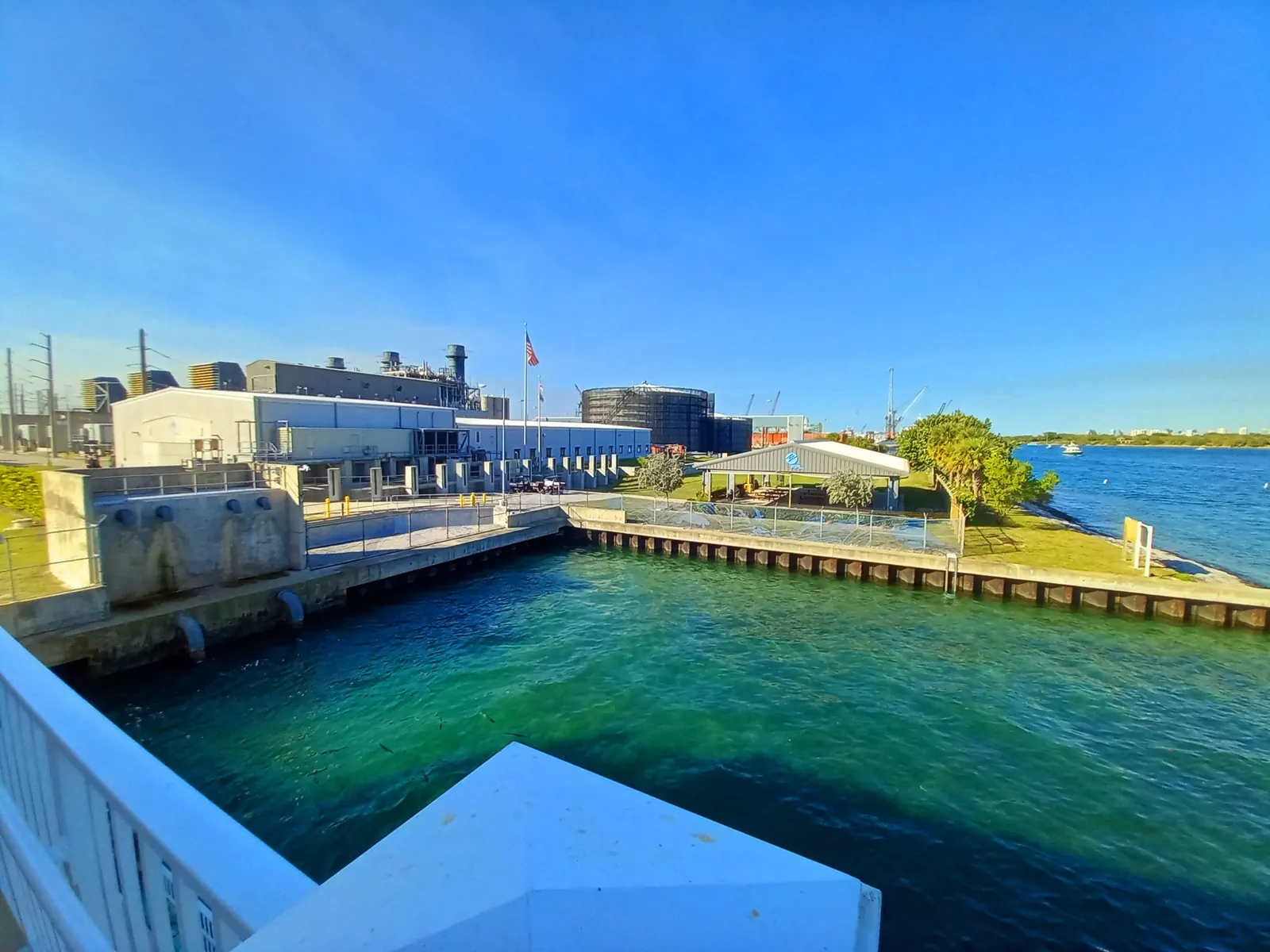
Palm Beach County’s Phil Foster Memorial Park page calls the Blue Heron Bridge area “internationally recognized” for marine life. It describes a snorkel trail of limestone boulders and prefabricated reef modules spread over a two-acre area in 6 to 10 feet of water, built with 600 tons of rock. The County adds that “Squid, octopus, spotted rays and starfish are regularly seen.” DAN gives different numbers for the wider dive site: depths averaging around 15 feet, with a maximum of 25 feet. The two figures describe different things, so we quote both and name the source of each.
- Diving is permitted from sunrise to sunset outside the guarded swimming area. Dive instruction, including group night dives, needs a County permit.
- Swimming is prohibited outside the guarded area beside the Blue Heron Boulevard bridge, including from docks, piers, bulkheads and boat ramps.
- Harvesting or possessing tropical fish or tropical ornamental marine plants is prohibited in the park and its waters (Rule 68B-42, F.A.C.), and knives or spear guns may not be used to capture fish in County park waters.
- Boaters are asked to observe the operating speeds for the Boating Safety Zones throughout the lagoon, and no vessel may be operated through a designated swimming area.
Parking when the tide is right
The County lists 206 regular parking spaces and 127 boat and trailer spaces at the park, and it closes access temporarily when the lot is full. In the example week both weekend highs fell in the morning, at 7:18 a.m. on Sat., Oct. 24 and 8:04 a.m. on Sun., Oct. 25, and in weeks like that a weekend plan means an early start. The boat ramps are open 24 hours, and trailer parking needs a permit ($15 daily permit available onsite). The County’s daily beach conditions line for the park is 561-624-0065.
Planning another week
The same NOAA prediction file runs through Oct. 31, 2027. Our tides and seasons page shows the high and low tides for any date, and the Blue Heron Bridge snorkeling guide covers the trail, entry and rules in more depth. The 46-minute daily shift in the example week is a handy rule of thumb when you glance ahead, but read the table rather than counting forward. If the bridge lot is full, the County also lists a snorkeling lagoon on Peanut Island, which is boat access only.
- DAN's Alert Diver magazine (Jim and Deb Garber, Aug. 18, 2022): "Diving BHB revolves around slack high tide, which offers the calmest currents and best visibility." Depths average around 15 feet with a maximum of 25 feet. Divers Alert Network, Alert Diver: Blue Heron Bridge
- Palm Beach County: the Blue Heron Bridge area is "internationally recognized" for marine life. A snorkel trail of limestone boulders and prefabricated reef modules spans a two-acre area in 6 to 10 feet of water, built with 600 tons of rock. Palm Beach County Parks & Recreation: Phil Foster Memorial Park
- Palm Beach County: diving at Phil Foster Memorial Park is permitted from sunrise to sunset outside the guarded swimming area; dive instruction, including group night dives, needs a county permit. Palm Beach County Parks & Recreation: Phil Foster Memorial Park
- NOAA CO-OPS publishes tide predictions for station 8722588, Port of Palm Beach (26.77 N, 80.0517 W), a reference (harmonic) station. Its datum epoch is 1983-2001 and its station metadata lists the water-level gauge as removed in 2010. NOAA CO-OPS Metadata API: station 8722588
Snorkel questions
Where is the Blue Heron Bridge snorkel trail?
At Phil Foster Memorial Park in Riviera Beach. The county says the trail of limestone boulders and reef modules covers two acres in 6 to 10 feet of water and used 600 tons of rock.
Source: Palm Beach County Parks & Recreation: Phil Foster Memorial Park
When is the best time to snorkel or dive the Blue Heron Bridge?
Around slack high tide. DAN's Alert Diver says diving there "revolves around slack high tide, which offers the calmest currents and best visibility." Use the Port of Palm Beach tide predictions on this site to plan.
Source: Divers Alert Network, Alert Diver: Blue Heron Bridge
What are the diving rules at Phil Foster Park?
The county allows diving from sunrise to sunset outside the guarded swimming area. Dive instruction, including group night dives, needs a county permit. Taking tropical fish or using knives or spear guns to catch fish in county park waters is not allowed.
Source: Palm Beach County Parks & Recreation: Phil Foster Memorial Park
Can I swim in the lagoon?
Only where it is allowed. At Phil Foster Park the county allows swimming only in the guarded swimming area, not from docks, piers, bulkheads or ramps. Check current water quality first; this guide never claims the water is safe to swim.
Source: Palm Beach County Parks & Recreation: Phil Foster Memorial Park
Which tide station should I use for the lagoon?
This guide uses NOAA station 8722588, Port of Palm Beach, the nearest NOAA tide prediction station to the Lake Worth Inlet and Blue Heron Bridge. NOAA also lists stations at Palm Beach, Lake Worth ICW and Boynton Beach for the central and south lagoon.
Source: NOAA CO-OPS
Written by the Lake Worth Lagoon Guide Editorial Team. AI tools help us draft; people check every fact before it publishes.
Dates, rules and hours can change. The organisers have the final word: Palm Beach County Environmental Resources Management: Lake Worth Lagoon