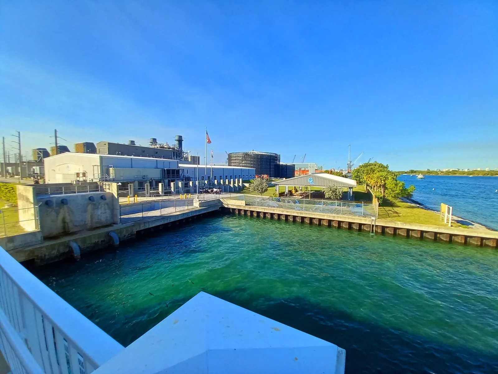
Manatee Lagoon, the FPL Eco-Discovery Center in West Palm Beach, is the place most people mean when they search for manatees on the Lake Worth Lagoon. Its own site is the authority on its hours and programs, and we link to it. This page answers the wider questions: when the manatees come, why they come here, what you can and cannot do at the center, and what boaters need to know. It was checked on Tuesday, Oct. 20, 2026.
When manatees are in the lagoon
Palm Beach County Environmental Resources Management (ERM) says manatees are in the lagoon all year. When the temperature drops, their numbers spike, as manatees migrating along the coast look for warmer water. In cold snaps they gather in the warm water near the discharge of the FPL Riviera Beach Power Plant, which ERM says is “recognized as one of the most important water manatee refuges on the east coast of Florida”.
So the best viewing is on cold days in winter, not on a set date. Manatee Lagoon names November 15 to March 31 as manatee season and opens every day during it.
- Palm Beach County ERM says manatees are in the lagoon all year, and when the temperature drops their numbers spike as manatees migrating along the coast find warmer water. Palm Beach County ERM: Lake Worth Lagoon
- Palm Beach County ERM says that in cold snaps manatees congregate in the warm water near the FPL Riviera Beach Power Plant discharge, "recognized as one of the most important water manatee refuges on the east coast of Florida", and points visitors to the Manatee Lagoon education facility there. Palm Beach County ERM: Manatees
Visiting Manatee Lagoon
| What | What Manatee Lagoon lists |
|---|---|
| Address | 6000 N. Flagler Drive, West Palm Beach |
| Hours | 9 a.m. to 4 p.m. |
| Manatee season | Open daily, November 15 to March 31 |
| Rest of the year | Closed on Mondays, April 1 to November 14 |
| Admission | Free to visit |
| Parking | Free onsite parking |
| Programs | Free public programs; some need pre-registration |
- Manatee Lagoon: "Closed on Mondays from April 1 – November 14. Open daily during manatee season, November 15 – March 31." Manatee Lagoon – An FPL Eco-Discovery Center
- Manatee Lagoon, An FPL Eco-Discovery Center, says it is "dedicated to educating the public about manatees and Lake Worth Lagoon". Manatee Lagoon – An FPL Eco-Discovery Center
On the day we checked, the center was in its Monday-closed period; manatee season, and daily opening, begins on Sunday, Nov. 15, 2026. The upstairs space and observation deck close during private events. The center listed Oct. 1, 6, 13, 14, 20, 26 and 27, 2026 as private event dates, so check Manatee Lagoon’s visit page before a trip to the deck.
What is not allowed
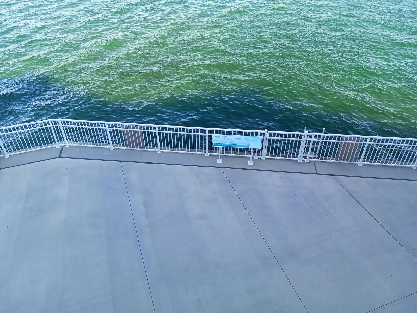
Manatee Lagoon has no water access. Fishing and swimming are prohibited. Pets are not allowed, though service animals as defined by the ADA are. Drones and feeding wildlife are prohibited.
Is Manatee Lagoon worth it?
It is free, parking is free, and it sits on the warm-water refuge ERM describes, so on a cold winter day it is the public place ERM itself points visitors to for seeing manatees. In warm months, ERM says manatees are still in the lagoon, but the gathering that draws crowds happens when temperatures drop. Time a visit for a cold spell between Nov. 15 and March 31 and you have the best chance.
Manatee events
Manatee Lagoon describes two recurring events, a free, family-friendly Migration Celebration that welcomes manatees back to warmer water and ManateeFest, its annual anniversary celebration with exhibitors and a kids fun zone. Neither had a published date when we checked. Look on the center’s events page. Dated events appear below as soon as they are confirmed.
Manatee Lagoon manatee season: open daily
Organiser date for 2026Manatee Lagoon says it is open daily during manatee season, November 15 to March 31, and closed on Mondays from April 1 to November 14.
Recurring annual window stated on the Manatee Lagoon site.
Add to calendar: Google Apple / Outlook (.ics)
Source: Manatee Lagoon – An FPL Eco-Discovery Center, checked 2026-10-20
Manatee Lagoon Migration Celebration
Undated; do not show a date.Manatee Lagoon describes a free, family-friendly Migration Celebration welcoming manatees back to warmer waters. No date was visible on the page.
Free Source: Manatee Lagoon: Events, checked 2026-10-20
ManateeFest (Manatee Lagoon anniversary celebration)
Undated; do not show a date.Manatee Lagoon calls ManateeFest its annual anniversary celebration, with exhibitors and a kids fun zone, focused on manatees and the Lake Worth Lagoon. No date was visible on the page.
Source: Manatee Lagoon: Events, checked 2026-10-20
Other places manatees use
ERM says seagrass is food for green sea turtles and manatees. FWC’s seagrass report puts most of the lagoon’s seagrass, 65%, in the northern lagoon near Singer Island, with 12% in the central segment and 23% in the south. ERM lists the West Indian manatee among the wildlife at the Snook Islands Natural Area in Lake Worth Beach, and says the restored wetlands at South Cove on the West Palm Beach waterfront support manatees too. These are restored public areas, not viewing platforms, and nobody publishes when manatees are there.
- Palm Beach County ERM says seagrass is food for green sea turtles and manatees and breaks down into matter that forms the base of the food chain. Palm Beach County ERM: Lake Worth Lagoon
- FWC's seagrass report says most of the seagrass (65%) is in the northern lagoon near Singer Island, 12% in the central segment and 23% in the southern segment. FWC FWRI SIMM report: Lake Worth Lagoon chapter (TR-17)
Boaters: manatee protection zones
The state zones for the lagoon are in Florida Administrative Code rule 68C-22.009, Palm Beach County Zones, an FWC rule that flrules.org lists as effective 7/20/1993. The rule regulates motorboat speed and operation in Palm Beach County manatee protection areas “between the dates of November 15 and March 31 of each year” for its seasonal paragraphs, and year round for the others. Those seasonal dates match Manatee Lagoon’s season, but the two are set separately: one by state rule, one by the center.
- Florida Administrative Code rule 68C-22.009 (Palm Beach County Zones) regulates motorboat speed and operation in Palm Beach County manatee protection areas "between the dates of November 15 and March 31 of each year, paragraphs (b), (d), and (e); year-round but seasonally-differentiated, paragraph (g); and year-round, paragraphs (a), (c), and (f)". flrules.org lists the rule's effective date as 7/20/1993. Florida Administrative Code 68C-22.009, Palm Beach County Zones (FWC), rule text from flrules.org
The posted markers govern
Rule 68C-22.009(3) says: “Where differing regulations exist, regulatory markers posted shall reflect the most restrictive requirement. Permitted markers as posted are presumptive evidence of zone boundaries, as intended.” The rule’s maps date from 1990 to 1993, and where a map and the written description conflict, the description prevails. Our summary below is a reading aid, not a chart: on the water, follow the signs.
- Rule 68C-22.009(3): "Where differing regulations exist, regulatory markers posted shall reflect the most restrictive requirement. Permitted markers as posted are presumptive evidence of zone boundaries, as intended." Subsection (5) says the zones are depicted on Palm Beach County manatee protection zone maps (Map A through Map F dated November 1990, plus 1991 and 1993 maps) and "In the event of conflict between the two, the above descriptions shall prevail." Florida Administrative Code 68C-22.009(3) and (5)
The zones, north to south, as the rule describes them
| Zone (rule paragraph) | When | Where, in the rule’s terms |
|---|---|---|
| Motorboats prohibited (1)(e) | Posted each year | Waters around the Riviera Beach Power Plant discharge canal, “inclusive of the entire waterbody comprising the Riviera Beach Power Plant discharge canal”. “The precise boundaries and effective period of the zone will be posted each year between November 15 and March 31.” |
| Slow speed (1)(c)8-9 | Year round | Within 300 feet of the shoreline south of the Blue Heron Boulevard Bridge: on the east side to the Lake Worth Inlet’s red “10” / green “9” line, “including those nearshore waters within 300 feet of Peanut Island and all other islands”; on the west side to the Port of Palm Beach turning basin. The inlet channel and main marked ICW channel are excluded. |
| Slow speed (1)(d)6 | Nov. 15 to March 31 | From the north shoreline of Phil Foster Island (about 650 feet north of the Blue Heron Boulevard Bridge centerline) south to the turning basin marker line, excluding the inlet east of the Singer Island line. |
| Idle speed (1)(b) | Nov. 15 to March 31 | “All waters of Lake Worth” from the turning basin marker line (west from the inlet’s red “10” to the mainland) south to “an east-west line one mile south of an east-west line drawn along the southern end of Peanut Island”, shore to shore, except the power plant zone. |
| Idle speed (1)(a) | Year round | From the southern edge of the turning basin south to the same one-mile line: “All waters along the westerly side of Lake Worth” west of the marked Intracoastal channel, and “All waters within 300 feet of the general contour of the shoreline” on the Palm Beach Island side, except the channel from daymark R “2” to R “6”. |
| Slow speed (1)(d)1 | Nov. 15 to March 31 | “All waters southerly of an east-west line parallel to and one mile south of an east-west line drawn along the southern end of Peanut Island and northerly of an east-west line parallel to and 1.75 miles south” of it. |
| Slow speed (1)(c)3 | Year round | The westerly side of Lake Worth, west of the marked Intracoastal channel, from the one-mile line south of Peanut Island to the Flagler Memorial Bridge (A1A). |
| Slow speed (1)(c)4 | Year round | Within 300 feet of the shoreline from the one-mile line south of Peanut Island to the Lantana Avenue (SR 812) Bridge, including within 300 feet of all islands; the main marked Intracoastal channel is excluded. |
| Slow speed (1)(c)10 | Year round | “All waters, including associated backwaters” from the Lantana Avenue Bridge south to a line through flashing red “52”, about 0.6 mile north of the East Ocean Avenue Bridge in Boynton Beach, excluding the Intracoastal channel, the Boynton Inlet channel and listed areas near Hypoluxo Island. |
| Slow speed (1)(c)17-18 | Year round | The West Palm Beach (C-51) Canal east of US 1 (Structure S-155), and the Boynton (C-16) Canal east of US 1 (Structure S-41), each to where it meets the Intracoastal. |
- Rule 68C-22.009(1)(e) (headed "Motorboats Probitied Zone" [sic] in the rule text) covers the Lake Worth waters around the Riviera Beach Power Plant discharge canal, "inclusive of the entire waterbody comprising the Riviera Beach Power Plant discharge canal". The rule says: "The precise boundaries and effective period of the zone will be posted each year between November 15 and March 31." Florida Administrative Code 68C-22.009(1)(e)
- Rule 68C-22.009(1)(c)8 and (c)9, "Slow Speed (Year-round)": waters within 300 feet of the shoreline on the easterly side of Lake Worth from the Blue Heron Boulevard Bridge south to the red "10" / green "9" line, "including those nearshore waters within 300 feet of Peanut Island and all other islands", and on the westerly side from the Blue Heron Boulevard Bridge south to the Port of Palm Beach Turning Basin, excluding the Lake Worth Inlet channel and the main marked ICW channel. Florida Administrative Code 68C-22.009(1)(c)8-9
- Rule 68C-22.009(1)(d), "Slow Speed (Seasonal)" (November 15 to March 31): (d)1 covers "All waters southerly of an east-west line parallel to and one mile south of an east-west line drawn along the southern end of Peanut Island and northerly of an east-west line parallel to and 1.75 miles south" of it; (d)6 covers the waters of Lake Worth from the north shoreline of Phil Foster Island (about 650 feet north of the Blue Heron Boulevard Bridge centerline) south to the Port of Palm Beach Turning Basin marker line, excluding the Lake Worth Inlet east of the Singer Island line. Florida Administrative Code 68C-22.009(1)(d)
- Rule 68C-22.009(1)(b), "Idle Speed Zone (Seasonal)" (November 15 to March 31): "All waters of Lake Worth" bounded on the north by the line of channel markers along the northern edge of the Port of Palm Beach Turning Basin (from Lake Worth Inlet flashing red marker "10") west to the mainland, on the northeast by a line from red "10" through green "9" to Palm Beach Island, on the east and west by the lagoon shorelines, and on the south by "an east-west line one mile south of an east-west line drawn along the southern end of Peanut Island", except waters designated under paragraph (1)(e). Florida Administrative Code 68C-22.009(1)(b)
- Rule 68C-22.009(1)(a)1, "Idle Speed Zone (Year-round)": "All waters along the westerly side of Lake Worth" from the southern edge of the Port of Palm Beach Turning Basin south to the line one mile south of the southern end of Peanut Island, bounded on the east by "the western boundary of the marked channel of the Atlantic Intracoastal Waterway" and on the west by the western shoreline. Paragraph (1)(a)2 adds a year-round idle zone in "All waters within 300 feet of the general contour of the shoreline" along the easterly side of Lake Worth (Palm Beach Island) over the same north-south span, excluding the partially marked channel from daymark R "2" to R "6". Florida Administrative Code 68C-22.009(1)(a)
- Rule 68C-22.009(1)(c)4, "Slow Speed (Year-round)": "All waters within 300 feet of the general contour of the shoreline from an east-west line one mile south of an east-west line drawn along the southern end of Peanut Island south to the Lantana Avenue (SR 812) Bridge in Lantana, including those nearshore waters within 300 feet of all islands, whether natural or manmade", excluding the main marked channel of the Atlantic Intracoastal Waterway. Paragraph (1)(c)3 makes the westerly side of Lake Worth from that line south to the Flagler Memorial Bridge (A1A), west of the marked ICW channel, a year-round slow speed zone. Florida Administrative Code 68C-22.009(1)(c)3-4
- Rule 68C-22.009(1)(c)10, "Slow Speed (Year-round)": "All waters, including associated backwaters, from the Lantana Avenue Bridge (SR 812) in Lantana south to an east-west line running through flashing red marker "52" approximately 0.6 mile northerly of the East Ocean Avenue Bridge in Boynton Beach", excluding the Atlantic Intracoastal Waterway channel, the marked east-west channel of Boynton Inlet, and other listed carve-outs near Hypoluxo Island. Florida Administrative Code 68C-22.009(1)(c)10
- Rule 68C-22.009(1)(c)17-18, "Slow Speed (Year-round)": "All waters of the West Palm Beach (C-51) Canal easterly of US 1 (Structure S-155) to its confluence with the Atlantic Intracoastal Waterway" and "All waters of the Boynton (C-16) Canal easterly of US 1 (Structure S-41) to its confluence with the Atlantic Intracoastal Waterway." Florida Administrative Code 68C-22.009(1)(c)17-18
Where zones overlap, the most restrictive one is what the markers show. The rule also has a year-round, seasonally differentiated paragraph, (1)(g), whose text we have not summarized here; read the full rule on flrules.org.
Two related rules: FWC says local manatee protection zones must be approved by FWC and cannot include the main marked channel of the Florida Intracoastal Waterway or waters within 100 feet of it. Palm Beach County asks boaters to observe the operating speeds of the Boating Safety Zones throughout the lagoon. FWC’s overview is on its manatee protection zones page.
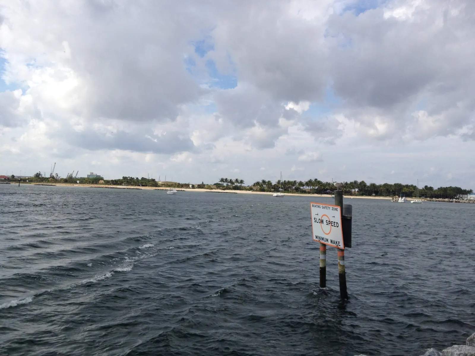
- FWC says local manatee protection zones must be approved by FWC and "cannot include waters within the main marked channel of the Florida Intracoastal Waterway or waters within 100 feet thereof." FWC: Manatee Protection Zones
- Palm Beach County Parks asks boaters, for public safety and to protect manatees, "to observe the operating speeds established for the Boating Safety Zones located throughout the Lake Worth Lagoon", and vessels may not be operated through any designated swimming area. Palm Beach County Parks & Recreation: Phil Foster Memorial Park
Plan by date
The date tool marks whether a day falls in Manatee Lagoon’s season or its Monday-closed period, along with the tides and other lagoon seasons.
Decision tool · tides and seasons
What is the lagoon doing on this date?
Pick a date. We show NOAA's predicted high and low tides at the Port of Palm Beach, mark daytime high tides for a Blue Heron Bridge snorkel, and list the fishing seasons, Manatee Lagoon's season and the dated events that fall on it.
Tides for the next three days
Fri, Nov 20
- High 4:07 a.m.3.1 ft
- Low 10:13 a.m.0.9 ft
- High 4:18 p.m.3.0 ft
- Low 10:26 p.m.0.4 ft
Sat, Nov 21
- High 4:59 a.m.3.4 ft
- Low 11:07 a.m.0.8 ft
- High 5:06 p.m.3.0 ft
- Low 11:14 p.m.0.2 ft
Sun, Nov 22
- High 5:49 a.m.3.6 ft
- Low 12:00 p.m.0.6 ft
- High 5:54 p.m.3.1 ft
Predicted high and low tides at NOAA station 8722588 Port of Palm Beach, in local time, heights in feet above MLLW. Predictions, not measurements: wind and rain shift the real water. Daytime highs are marked. Source: NOAA CO-OPS Tides and Currents, station 8722588 Port of Palm Beach, fetched 2026-10-20.
The published seasons and events this checker uses
- Spiny lobster regular season: FWC: "Season: Aug. 6-March 31". Carapace larger than 3 inches, measured in the water. FWC: Spiny Lobster recreational regulations
- Manatee Lagoon closed Mondays: Manatee Lagoon: "Closed on Mondays from April 1 – November 14." Manatee Lagoon – An FPL Eco-Discovery Center
- Atlantic hurricane season: NOAA NHC: "The Atlantic hurricane season runs from June 1 to November 30." NOAA National Hurricane Center: Tropical Cyclone Climatology
- Lake Worth Lagoon Initiative meeting (open to the public): October 21, 2026, 2pm – 4pm · See meeting information on the LWLI page Palm Beach County ERM: Lake Worth Lagoon Initiative
- LagoonFest 2026: Saturday, October 31, 2026, 8:30 am – 2:00 pm · Flagler Drive, downtown West Palm Beach Discover The Palm Beaches: 2026 LagoonFest Activity Outline
- Manatee season at Manatee Lagoon (open daily): Manatee Lagoon: open daily during manatee season, November 15 – March 31. Palm Beach County ERM says manatee numbers in the lagoon spike when temperatures drop. Manatee Lagoon – An FPL Eco-Discovery Center
- Snook closed season (winter), Southeast region: FWC Southeast region (Martin-Palm Beach county line south): closed December 15 – January 31. Catch-and-release only. Slot when open: 28 to 32 inches total length; snook permit plus license. FWC: Snook recreational regulations
- Snook closed season (summer), Southeast region: FWC Southeast region: closed June 1 – August 31. FWC: Snook recreational regulations
- Spiny lobster sport (mini) season: July 28-29, 2027 · Florida state waters (statewide rule) FWC: Spiny Lobster recreational regulations
Tides: NOAA CO-OPS predictions for station 8722588 Port of Palm Beach, fetched 2026-10-20. Seasons: FWC (snook, spiny lobster), Manatee Lagoon (FPL), NOAA National Hurricane Center. Events: each organizer's own page or document. Checked 2026-10-20.
Know your tide? Find the public ramp, launch or park that fits what you want to do.
Sources: Palm Beach County ERM: Manatees, ERM: Lake Worth Lagoon, Manatee Lagoon.
Quick answers
When can I see manatees?
Manatees are in the lagoon all year, the county says, but numbers spike when the temperature drops. In cold snaps they gather in the warm water near the FPL Riviera Beach power plant, which the county calls one of the most important manatee refuges on Florida's east coast.
Source: Palm Beach County ERM: Manatees
When is Manatee Lagoon open?
Manatee Lagoon, An FPL Eco-Discovery Center, says it is open daily during manatee season, November 15 to March 31, and closed on Mondays from April 1 to November 14.
Are there manatee speed zones in the lagoon?
Yes. Palm Beach County Parks asks boaters to observe the speeds set for the Boating Safety Zones throughout the Lake Worth Lagoon, for public safety and to protect manatees. Check the posted signs and FWC's Palm Beach County zone maps for exact limits and dates before you go.
Source: Palm Beach County Parks & Recreation: Phil Foster Memorial Park
Dates, rules and hours can change. The organisers have the final word: Palm Beach County Environmental Resources Management: Lake Worth Lagoon